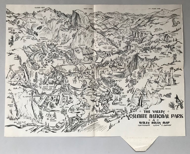
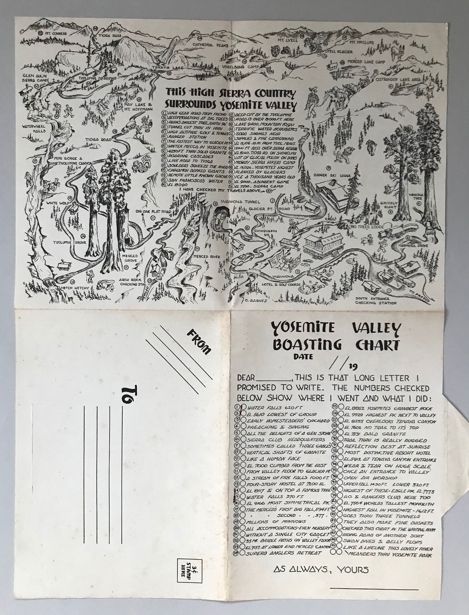
The Valley, Yosemite National Park. A Willy Nilly Map. N.p., n.d. [1946]. Large pictorial tourist map, 36 x 48.5 cm (14 x 19 inches), printed on both sides on cream paper stock. Copyright 1946. Visitor services, pack routes, hiking trails, mountains and mountain passes and other features of interest are keyed to a 47-item "Yosemite Valley Boasting Chart" on the verso. Verso also has a smaller map by Barnes, 24 x 36 cm (9 1/2 x 14 inches), "This High Sierra Country Surrounds Yosemite Valley" with a 32-item key. A humorous souvenir map designed to be folded and mailed. There are probably at least two printings of this Yosemite map, this one with no printer's imprint, and the other, listed by OCLC with no location recorded, that measures 44 x 56 cm and has a San Francisco printer's imprint: "Crown Print. and Lithographing Co." Barnes published two other similar maps of the Sierra Nevada; Sequoia National Park (1945) and Three Rivers, California and Mineral King in the High Sierras (1945). Mild tanning, light foxing to verso (mostly the address panel), a nearly fine copy. (#165120).
"Coming Soon"