
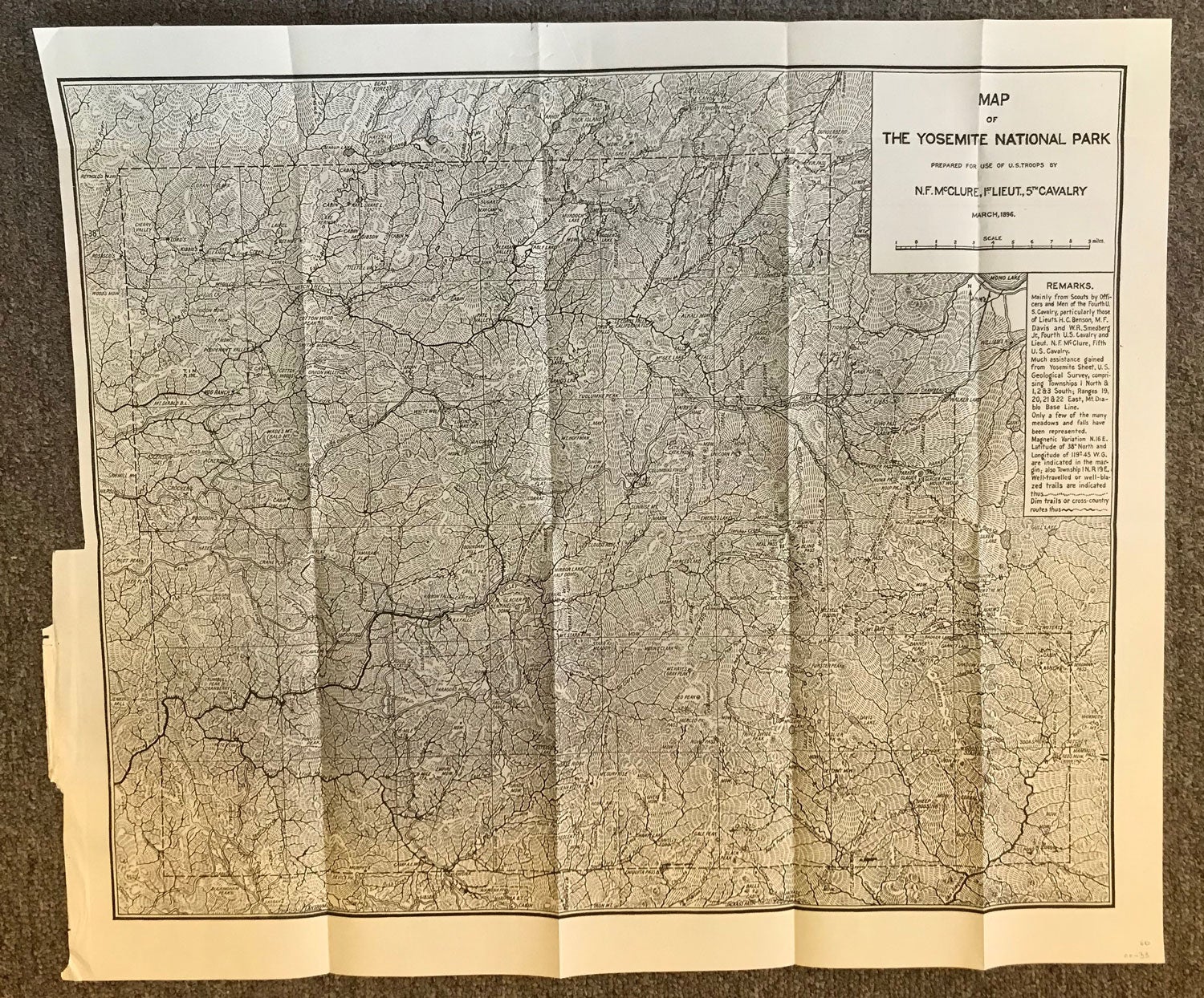
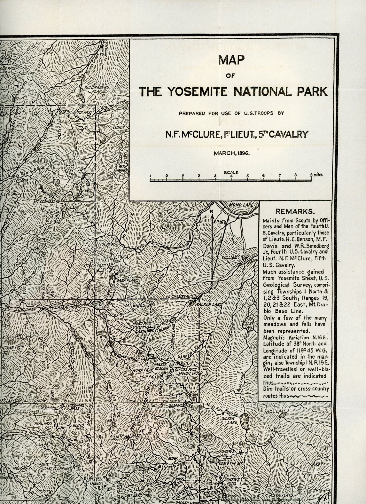
Map of the Yosemite National Park prepared for use of U. S. troops by N. F. McClure, 1st Lieut., 5th Cavalry March, 1896. N.p., n.d. [1900?]. Map. 46.3 x 53.5 cm; 18.25 x 22 inches (including borders). Nathaniel Fish McClure, born in Kentucky, 1865, commissioned second lieutenant on graduation from West Point, 1887, was stationed in Yosemite National Park in 1894 and 1895. The map shows "well-traveled or well-blazed trails" and "dim trails or cross-country routes" compiled "mainly from scouts by officers and men of the fourth U. S. Cavalry, particularly those of Lieuts. H. C. Benson, M. F. Davis and W. R. Smedberg Jr., Fourth U. S. Cavalry and Lieut. N. F. McClure, Fifth U. S. Cavalry." The map was published in Report of the Acting Superintendent of the Yosemite National Park, 1900. It was reprinted in the Reports for 1902, 1903 and 1904. A fine copy. (#165514).
"Coming Soon"