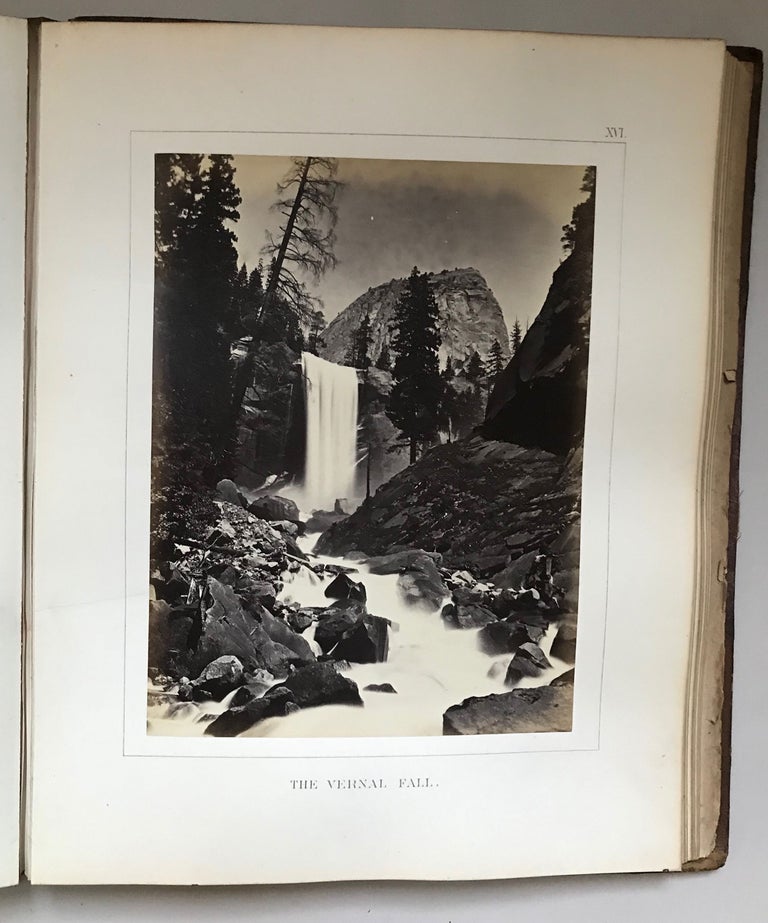
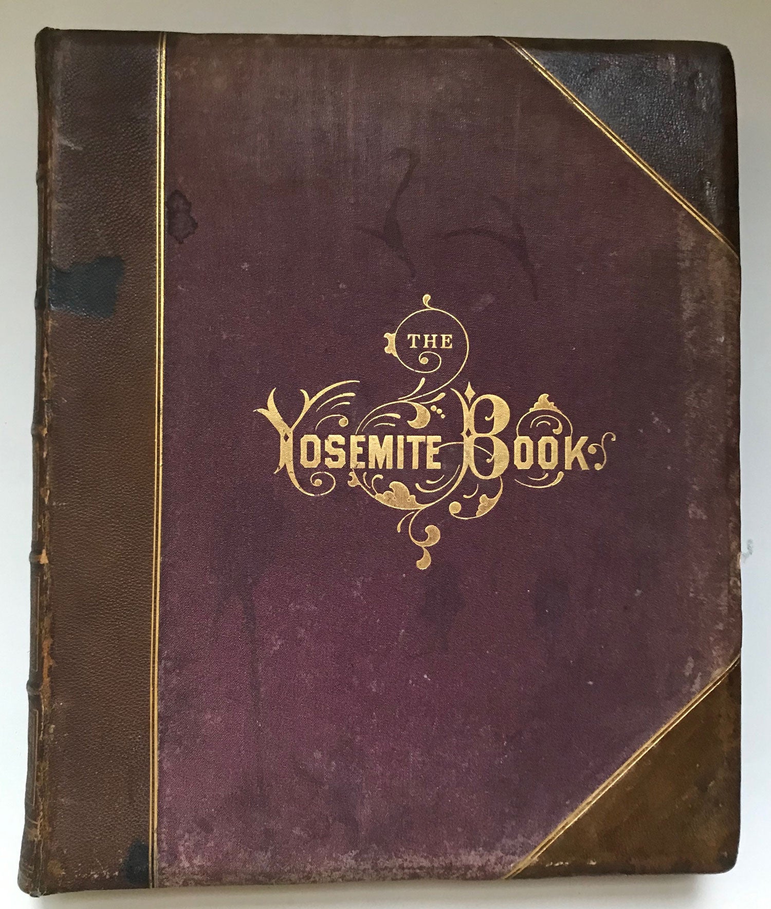
The Yosemite book; a description of the Yosemite Valley and the adjacent region of the Sierra Nevada, and of the big trees of California, illustrated by maps and photographs. Published by Authority of the Legislature. New York: Julius Bien, 1868. 30.3x24.7 cm (quarto), pp. [1-5] 6-116 [117-118: blank] [119: section title "PHOTOGRAPHS AND MAPS"] [120: blank], flyleaves at front and rear, 28 photographic images mounted on heavy card stock, 2 folded maps, title page printed in red and black, original three-quarter bevel-edged brown leather and purple cloth, front panel lettered and ruled in gold, spine panel lettered and richly tooled in gold, rear panel ruled in gold, all edges gilt, marbled endpapers. First edition. 250 copies printed. At head of title: "Geological Survey of California. / J. D. Whitney, State Geologist." Printer's imprint on copyright page: "Printed by / the New York Lithographing, Engraving and Printing Company. / 16 & 18 Park Place." The two large folded maps are: "Map of the Yosemite Valley from Surveys Made by Order of the Commissioners to Manage the Yosemite Valley and Mariposa Big Tree Grove by C. King and J. T. Gardner 1865. Drawn by J. T. G." and "Map of a Portion of the Sierra Nevada Adjacent to the Yosemite Valley from Surveys Made by Chs. F. Hoffmann and J. T. Gardner, 1863-1867. Scale 2 miles to 1 inch." The "Map of the Yosemite Valley ..." is partially tinted in green; printer's imprint in lower right margin reads: "N. Y. Lith.g Engr.g Prt.g Co. 16 & 18 Park Place." The printer's imprint in the lower right margin of "Map of a Portion of the Sierra Nevada Adjacent to the Yosemite Valley ..." reads: "J. Bien, Lith, N. Y." The act of the California legislature, approved April 2, 1866, provided the legislative framework to survey Yosemite Valley and the Mariposa Grove and to explore the adjacent region for the purpose of preparing a "full description and accurate statistical report" to be published "in connection with the reports of the Geological Survey." The proposed publication was described by Whitney in Report of the Commissioners to Manage the Yosemite Valley and the Mariposa Big Tree Grove, for the Years 1866-7 (San Francisco: Towne and Bacon, 1868), p. 5: "The work will consist of text, maps, and photographic and other illustrations, and two editions will be issued -- one without photographs, the other with them. One will be called the 'Yosemite Guide Book,' the other the 'Yosemite Gift Book.'" "The Yosemite Gift Book" was intended "to be as elegant a volume as has ever been published in this country." On November 26, 1868 Whitney wrote to William H. Brewer: "I have received the first printed sheets of the Yosemite Book. Even the University Press people are obliged to admit that they never saw anything to beat it." The first copies of the completed book were delivered early in 1869. The Yosemite Book provides an extensive description of the Yosemite Valley, the surrounding High Sierra from the head of the Tuolumne to the head of the San Joaquin, and the big tree groves. The text was based largely upon a field survey made by King and Gardner in 1866 (unsatisfactory according to Whitney) which was completed in 1867 by Hoffmann. Most of the twenty-eight photographic images illustrating the work were made in Yosemite Valley and the Mariposa Grove by Carleton E. Watkins in 1866. Four images were made by W. Harris who accompanied Hoffmann to the head of the Tuolumne in 1867. The limitation on the number of copies of this work is explained in a note on page 13: "As only a small number of prints could be obtained from the photographic artist, the number of copies of the illustrated volume, or the present 'Yosemite Book,' which could be issued was necessarily limited to 250; another edition, without photographs, but with the maps, and intended to serve as a guide-book to the Yosemite Valley and its surroundings, will appear shortly after the issuing of this volume. It will be called 'The Yosemite Guide-Book'." The guidebook was published in the fall of 1869. The Yosemite Book is one of the major contributions to Sierra Nevada literature. See Farquhar (1948), title 7. Currey and Kruska 60. Farquhar 7a. Zamorano Select 32. Leather scuffed, some scuffing and spotting to cloth, inner hinges cracked but the binding is still firm, heavy foxing to inner sides of free endpapers and flyleaves, scattered foxing throughout the text, just a bit of occasional, very mild foxing to plate mounts, mostly at edges, all the albumen photographic prints are in excellent condition: rich tones, no fading. (#166208).
No statement of printing.