![(#166897) San Mateo Bridge the fast motor route between San Francisco, San Mateo and San Joaquin[,] Sacramento, Sierra[,] Yosemite and Los Angeles[.] Cross the Bay the fast way[.] San Francisco Bay Toll-bridge Co. San Mateo, California [cover title]. San Francisco Bay, SAN FRANCISCO BAY TOLL-BRIDGE CO.](https://lwcurrey.cdn.bibliopolis.com/pictures/166897.jpg?width=768&height=1000&fit=bounds&auto=webp&v=1682014714)
![San Mateo Bridge the fast motor route between San Francisco, San Mateo and San Joaquin[,] Sacramento, Sierra[,] Yosemite and Los Angeles[.] Cross the Bay the fast way[.] San Francisco Bay Toll-bridge Co. San Mateo, California [cover title].](https://lwcurrey.cdn.bibliopolis.com/pictures/166897_1.jpg?auto=webp&v=1682014714)
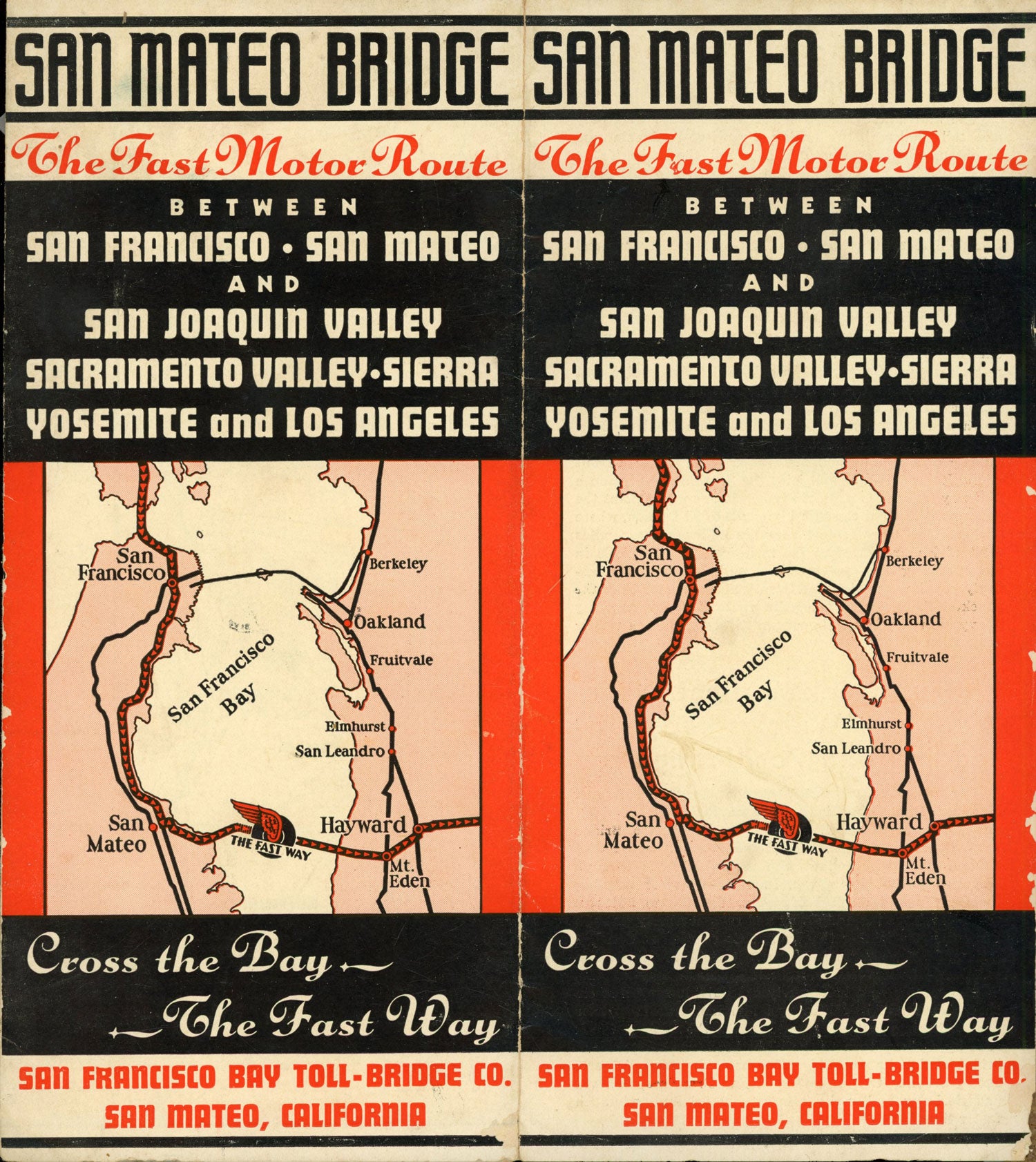
San Mateo Bridge the fast motor route between San Francisco, San Mateo and San Joaquin[,] Sacramento, Sierra[,] Yosemite and Los Angeles[.] Cross the Bay the fast way[.] San Francisco Bay Toll-bridge Co. San Mateo, California [cover title]. San Mateo, California: San Francisco Bay Toll-bridge Co., n.d. [1930s.]. Single sheet, 23x61 cm, folded to make 12 panels, 23x10.5 cm. 7 maps (1 duplicated on outer panels). Printer's imprint "San Mateo Times Print" at bottom of the text on last panel. Promotional brochure, printed in orange and black inks, advertising the San Mateo Bridge which opened to traffic on 3 March 1929. At the time, the bridge, built in fourteen months, was the longest highway bridge over water in the world. One paragraph promotes use of the bridge to access national parks and forests in the Sierra Nevada and notes that the "new 'General's Highway' now connecting these parks [General Grant National Park and Sequoia National Park], permits a loop trip." Wear and rubbing along several folds, a good copy. (#166897).
No statement of printing.