![(#166943) Pictorial map of Fresno County and mid-California’s garden of the sun. Published by the Fresno County Chamber of Commerce[,] Fresno, California [cover title]. FRESNO COUNTY CHAMBER OF COMMERCE.](https://lwcurrey.cdn.bibliopolis.com/pictures/166943.jpg?width=768&height=1000&fit=bounds&auto=webp&v=1682014889)
![Pictorial map of Fresno County and mid-California’s garden of the sun. Published by the Fresno County Chamber of Commerce[,] Fresno, California [cover title].](https://lwcurrey.cdn.bibliopolis.com/pictures/166943_1.jpg?auto=webp&v=1682014890)
![Pictorial map of Fresno County and mid-California’s garden of the sun. Published by the Fresno County Chamber of Commerce[,] Fresno, California [cover title].](https://lwcurrey.cdn.bibliopolis.com/pictures/166943_2.jpg?auto=webp&v=1682014890)
![Pictorial map of Fresno County and mid-California’s garden of the sun. Published by the Fresno County Chamber of Commerce[,] Fresno, California [cover title].](https://lwcurrey.cdn.bibliopolis.com/pictures/166943_3.jpg?auto=webp&v=1682014890)
![Pictorial map of Fresno County and mid-California’s garden of the sun. Published by the Fresno County Chamber of Commerce[,] Fresno, California [cover title].](https://lwcurrey.cdn.bibliopolis.com/pictures/166943_4.jpg?auto=webp&v=1682014891)
![Pictorial map of Fresno County and mid-California’s garden of the sun. Published by the Fresno County Chamber of Commerce[,] Fresno, California [cover title].](https://lwcurrey.cdn.bibliopolis.com/pictures/166943_alt.jpg?auto=webp&v=1682014891)
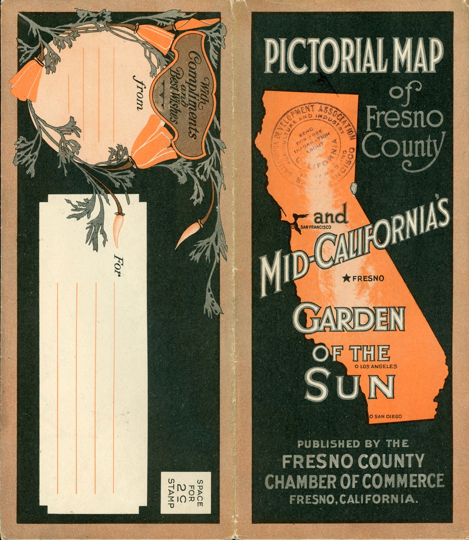
Pictorial map of Fresno County and mid-California’s garden of the sun. Published by the Fresno County Chamber of Commerce[,] Fresno, California [cover title]. Fresno, California: Published by Fresno County Chamber of Commerce, n.d. [Circa 1923]. A large color pictorial bird’s-eye view of California's lower Central Valley, 99.2x64 cm (39 x 25 1/4 inches), printed by "Schmidt Litho. Co., Fresno & S. F.," surrounded by thirty-one pictorial vignettes. Verso is a "Map of Fresno County Showing Principal Automobile Roads ... Route and Map Bureau California State Automobile Association 1628 Van Ness Ave, San Francisco," 49x64 cm (19 x 25 1/4 inches), plus nine panels of promotional information, all of which folds into a railroad timetable-size brochure, 25x10.8 cm. The map of Fresno County and promotional text is on the recto and the spectacular uncredited full-color bird’s-eye view of Fresno County surrounded by photographic vignettes that depict the region's agriculture, industry, residences and natural beauty is on the verso. The bird's-eye view shows not only Fresno County, but the neighboring counties of San Joaquin, Stanislaus, Merced, Madera, Kings, Tulare and Kern, as well as San Francisco and the coast to the west and the Sierra Nevada to the east, including Yosemite and the central and southern High Sierra. See: Hornsby, Stephen J. Picturing America: The Golden Age of Pictorial Maps, pp. 8-9. Light wear at edges and several tiny split at intersections, a very good copy. OCLC reports 6 copies. (#166943).
"Coming Soon"