![(#167682) CANDRIAN'S MAP OF CALIFORNIA [with] CANDRIAN'S RELIEF MAP OF CALIFORNIA AND NEVADA. Hermon Anton Candrian.](https://lwcurrey.cdn.bibliopolis.com/pictures/167682.jpg?width=768&height=1000&fit=bounds&auto=webp&v=1682014713)
![CANDRIAN'S MAP OF CALIFORNIA [with] CANDRIAN'S RELIEF MAP OF CALIFORNIA AND NEVADA.](https://lwcurrey.cdn.bibliopolis.com/pictures/167682_1.jpg?auto=webp&v=1682014713)
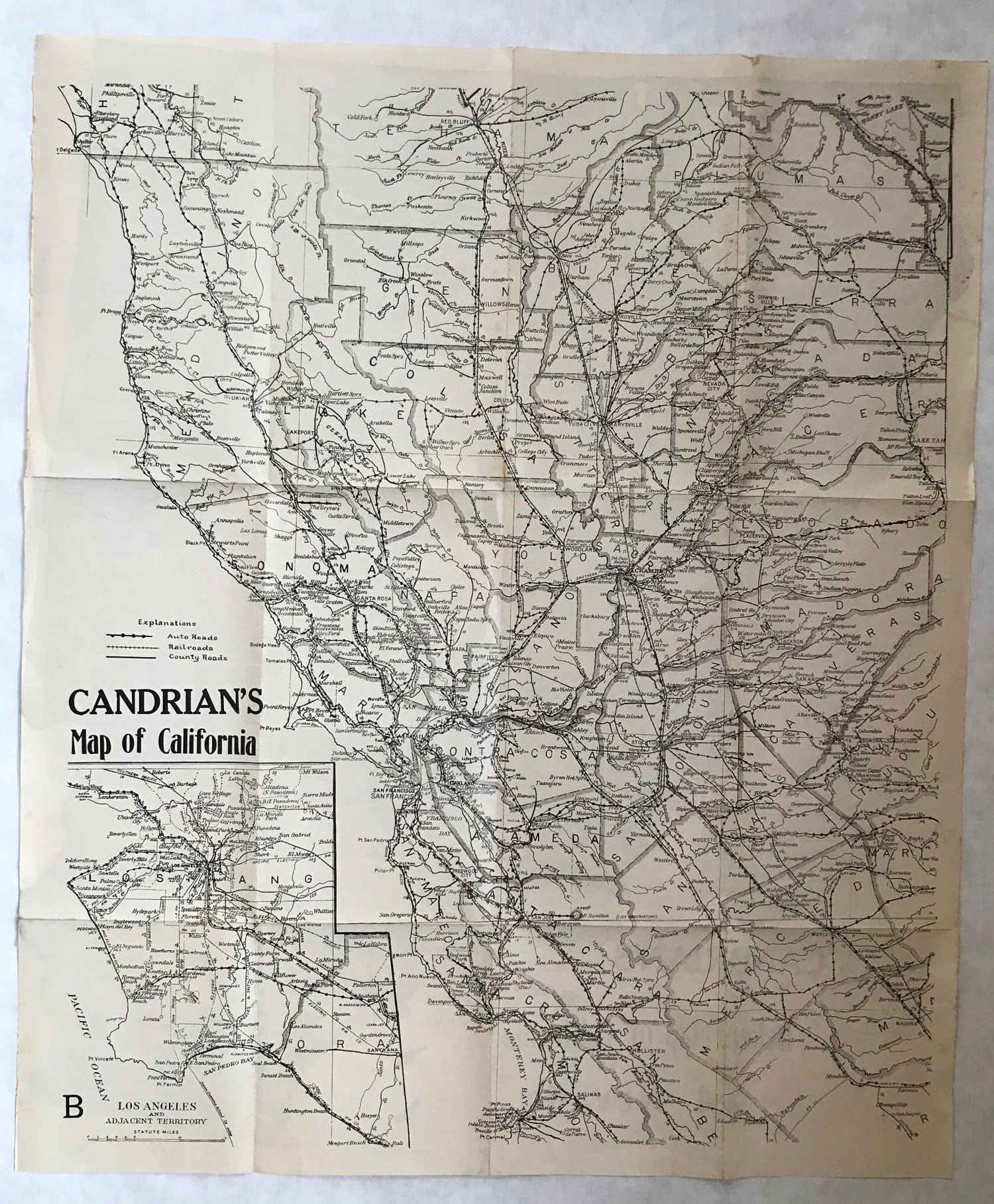
CANDRIAN'S MAP OF CALIFORNIA [with] CANDRIAN'S RELIEF MAP OF CALIFORNIA AND NEVADA. [San Francisco: H. A. Candrian], n.d. [Circa 1910.]. Single sheet, printed on both sides, 62.2x52.8 cm (24 1/2 x 20 3/4 inches), The large scale map of California, showing auto roads, county roads and railroads is the northern part of the state, from Salinas and Monterey Bay north to Red Bluff. The inset map is "Los Angeles and Adjacent Territory." The relief map of California and Nevada on the verso promotes the $18 million California state highways bond issue and shows paved, graded and surveyed (projected) state highways. Proposition 2, the California State Highway Bonds Proposition, was on the ballot in California on 8 November 1910. It was approved. The measure authorized an $18 million bond issue to build state highways. Hermon Anton Candrian (1852-1928), was a Swiss-American map publisher active in San Francisco in the first half of the twentieth century who specialized in maps of San Francisco and the San Francisco Bay region. A several tiny closed tears at edges, two small tape mends to margins, a very good copy. An important, early California motoring map. (#167682).
Price: $500.00
No statement of printing.