
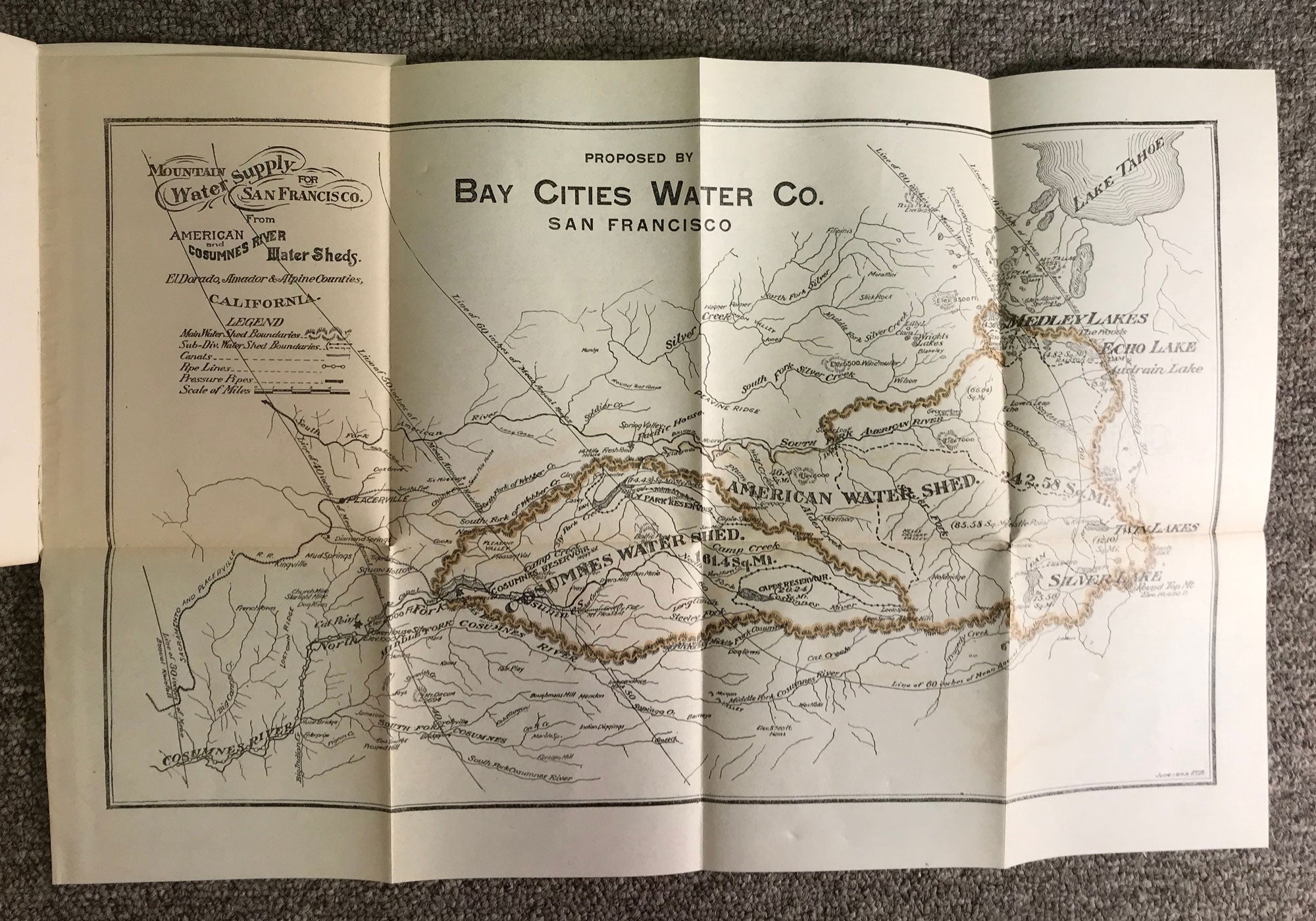
A communication from Bay Cities Water Company to the Board of Supervisors of the City and County of San Francisco proposing a source of water supply in the Sierra Nevada mountains. Filed at City Hall August, 1905. San Francisco: Bay Cities Water Company, 1905. 17.2 x 12.2 cm, pp. [1-4] [1] 2-10 [11-12] [note: first and last leaves are blank], 2 maps (folded), original gay wrappers printed in black, stapled. First edition. Cover title reads: "Mountain water for San Francisco proposition of Bay Cities Water Company to bring water from the Sierra Nevada mountains." The Bay Cities Water Company project would have utilized water from the American and Cosumnes rivers. The water system proposed by Bay Cities Water Company (incorporated 24 June 1902) was selected by San Francisco's Board of Supervisors, but graft prosecutions removed the Schmitz administration from office prior to preparation of a report on the system requested of the city engineer in December 1906. Includes two detailed maps, the first showing the American River and Cosumnes River watersheds outlined in brown, the second showing the chain of natural lakes to be used for water storage and the conduit lines and pipe line to carry the water to San Francisco. The title of the first map is "Mountain water supply for San Francisco. American and Cosumnes River Water Sheds. El Dorado, Amador & Alpine Counties, California ... Proposed by Bay Cities Water Co. San Francisco." The map measures 27.7 x 42.8 cm. The title of the second map is "Bay Cities Water Company's proposed Sierra Nevada water supply. From south fork of American River, and part of north fork of Cosumnes River, California, lying between Lake Tahoe and San Francisco. Showing chain of natural lakes to be used for storage of water, conduit lines and pipe line to San Francisco as located by Geo. H. Mendell, C. E." The map measures 24 x 30 cm. A very good copy. (#164837).
No statement of printing.