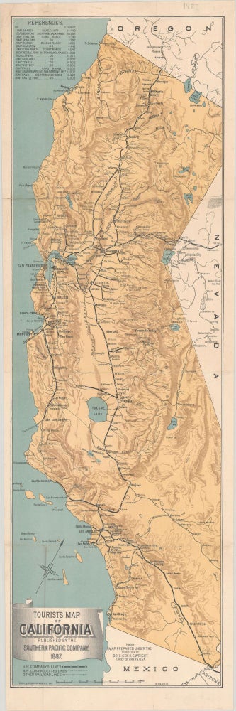
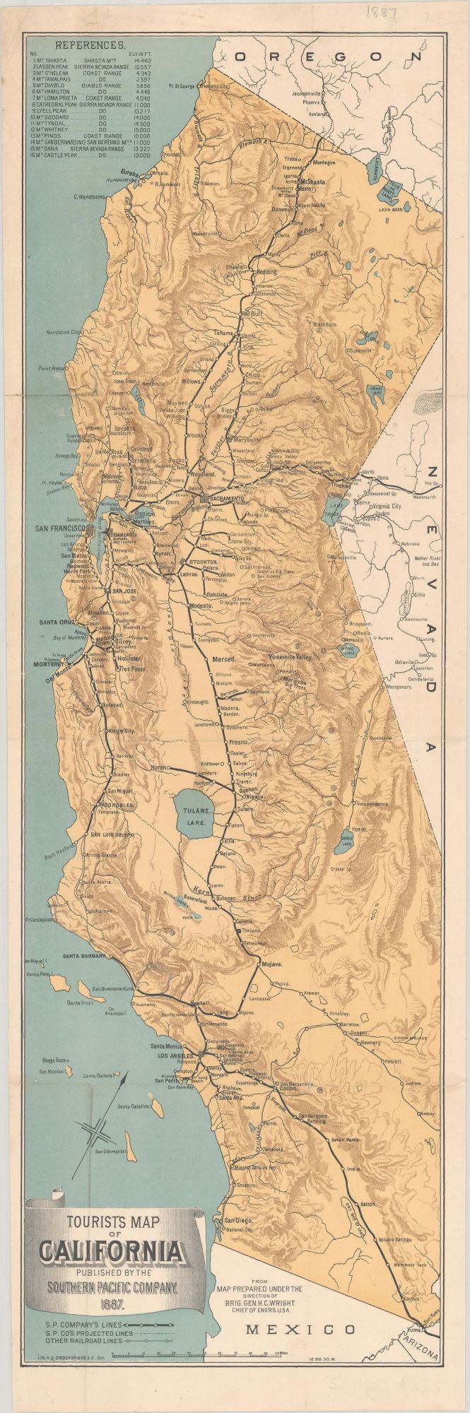
Tourist's map of California published by the Southern Pacific Company, 1887. From map prepared under the direction of Brig. Gen. H. C. Wright. Chief of Eng'rs. U. S. A." San Francisco: H. S. Crocker & Co., 1887 [i.e. 1886]. Single sheet, 24x79 cm. The map shows the completion of the Southern Pacific Company's "Shasta Route" between San Francisco, California, and Portland, Oregon. The Southern Pacific Company assumed control of the financially troubled Oregon and California Railroad, and in 1887 constructed the link over Siskiyou Summit, completing the route through northern California to Portland. The map shows the company's lines, projected lines and other railroad lines. The map emphasizes California resorts and recreation, including "references," a list of sixteen mountains and mountain regions, from Mt. Shasta south to the San Bernardino mountains, including Mt. Lyell, Mt. Whitney and three other peaks in the High Sierra. The map was printed in December 1886. An 1888 version of this map states that it was compiled by E. McD. Johnstone, a publicist employed by the Southern Pacific Company. The verso of the 1888 map is a time table with promotional material, "Southern Pacific Company Pacific System. Through time schedules double daily and weekly limited passenger train service by the central route." Several small holes and tears at intersections professionally mended, faint old folds; mounted on linen. (#167953).
Printer's code "12.86.30.M." at lower bottom right, just inside the double ruled border.